Back to Map
Old Faithful
Grand Teton
Fossil Butte
Sinks Canyon
Thermopolis Hot Springs
Hell's Half Acre
Vedauwoo
Devils Tower
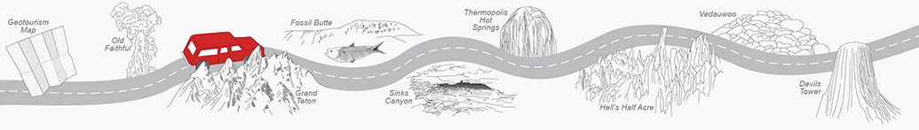
Discover the Geology of Grand Teton
 The jagged peaks and glacier-carved topography of the Teton Range in northwestern Wyoming are an
image often associated with the state. The tallest serrated point in this 40-mile stretch of
mountains is Grand Teton, which, at 13,722 feet above sea level, makes it the highest point
in Grand Teton National Park and the second highest in Wyoming.
The jagged peaks and glacier-carved topography of the Teton Range in northwestern Wyoming are an
image often associated with the state. The tallest serrated point in this 40-mile stretch of
mountains is Grand Teton, which, at 13,722 feet above sea level, makes it the highest point
in Grand Teton National Park and the second highest in Wyoming.
While most mountain ranges in the Rocky Mountains are 50 million years old or older, the
Teton Range is around 5 million years old and still actively shifting along a fault.
As impressively high as they appear from the Jackson Hole valley, the rocks of the Teton Range
have been uplifted a great deal more than what we now see. The Flathead sandstone, a 500-million-year-old deposit,
can be found at the top of Mount Moran, almost 6,000 feet above the valley floor,
while the same rocks are found more than 24,000 feet below the surface of the valley. That is a
total vertical offset of more than 30,000 feet, and the mountains are still rising today.
 Although the range is one of the youngest in the Rocky Mountains, it exposes some of the oldest
rocks in North America. Most of the range is composed of gneiss (metamorphic rock) that formed
when layers of seafloor sediments and volcanic flows were buried and deformed due to tectonic
activity about 2.8 billion years ago. Around 2.5 billion years ago, magma intruded into the gneiss,
cooled, and crystallized into granite, which makes up some of the highest peaks, including Grand
Teton.
Although the range is one of the youngest in the Rocky Mountains, it exposes some of the oldest
rocks in North America. Most of the range is composed of gneiss (metamorphic rock) that formed
when layers of seafloor sediments and volcanic flows were buried and deformed due to tectonic
activity about 2.8 billion years ago. Around 2.5 billion years ago, magma intruded into the gneiss,
cooled, and crystallized into granite, which makes up some of the highest peaks, including Grand
Teton.
More information about Grand Teton and the Teton Range can be found on the National Park Service website.
Additional resources:
Creation of the Teton Landscape
Tectonic History of Teton Region
Geologic Map of the Grand Teton National Park
- ►References
-
AAPG Datapages, Inc. Archives, 1978, An introduction to the Cambrian Flathead Sandstone,
Wind River Basin, Wyoming: Wyoming Geological Association, accessed February 2017, at
http://archives.datapages.com/data/wga/data/034/034001/79_wga0340079.htm.
Love, J.D., Reed, J.C., Jr., Pierce, K.L., 2003, Creation of the Teton landscape–A geological
chronicle of Jackson Hole & the Teton Range (2d ed.): Moose, Wyo., Grand Teton Natural History
Association, 122 p.
National Park Service, [n.d.], Grand Teton National Park, Wyoming–Geologic activity, accessed February 2017, at https://www.nps.gov/grte/learn/nature/geology.htm.
Contact:
Christina George, christina.george@wyo.gov