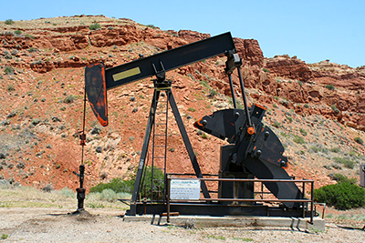
 2023 Oil & Gas Fields
This shapefile consists of named oil and gas fields within Wyoming, including the Powder River Basin coalbed methane field.
 Wyoming Coal Fields
Polygon file displaying coal fields within the State of Wyoming.
 Wyoming Coal Outcrops
This data set shows locations of coal outcroppings and related faults for the State of Wyoming in 2014.
Wyoming Coal Permit Boundaries
The GIS files located on this webpage contain current permit boundaries for all coal mines with active permits in Wyoming, created by the Land Quality Division (LQD) of the Wyoming Department of Environmental Quality (WDEQ).
 Wyoming Bedrock Geology
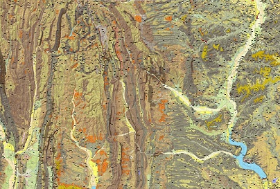
This data set consists of geologic formation contacts and polygons representing geologic units at 1:500,000 scale, created from the USGS Geologic Map of Wyoming by Love and Christiansen.
 Wyoming Surficial Geology
This data set represents surficial geology of Wyoming at 1:500,000 scale.
 Wyoming Mines and Minerals
This data set is a compilation of Wyoming's mines and minerals (August 2023).
Additional and recently updated information may be found using the online Mineral Resources of Wyoming Map.
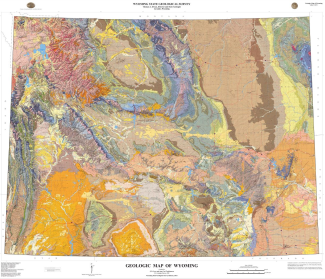
 Wyoming Faults
This data set consists of lines representing geologic faults at 1:500,000 scale. Created from the USGS Geologic Map of Wyoming by Love and Christiansen.
 Wyoming Dikes
This data set consists of lines representing geologic dikes at 1:500,000 scale. Created from the USGS Geologic Map of Wyoming by Love and Christiansen.
 Wyoming Basins
This data set consists of basins in Wyoming.
 Wyoming Basin Axis
This data set consists of basins axes and direction of plunge.
 Bedrock Geology of Bridger Formation
This data set consists of polygons representing geologic units at 1:24,000 scale of the Bridger Formation in southwestern Wyoming.
 Powder River Basin Boundary
The Powder River Basin boundary based on generalized contact between Cretaceous and Tertiary bedrocks.
 Wyoming Mountain Peaks
This data set contains all mountains, peaks and buttes in Wyoming with significant elevation difference from surrounding area.
Yellowstone Geology
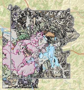
 Christiansen Geologic Summary Maps
This data set contains all the geologic map information used to publish U.S. Geological Survey Professional Paper 729-G by Christiansen, 2001.
 USGS Bedrock Geology
The data set consists of geologic units mapped as area (polygon) features.
 USGS Surficial Geology
The data set consists of surficial geologic units mapped as area (polygon) features.
 Caldera Boundaries
This data set was derived from the geology coverages of Plate 1, Plate 2, and Plate 3 in U.S. Geological Survey Professional Paper 729-G by Christiansen, 2001.
 Geothermal Areas
This data set contains boundaries for hydrogeothermal areas within Yellowstone National Park.
Yellowstone Hydrography
 USGS Bathymetry and Geology of the Floor of Yellowstone Lake
Data set resulting from the high-resolution multi-beam sonar mapping of Yellowstone Lake that was conducted by the U.S. Geological Survey in conjunction with the National Park Service.
 NPS Bathymetry of Yellowstone Lake
This National Park Service polygon coverage contains the measurements of depth for Yellowstone Lake.
 WSGS Bathymetry of Yellowstone Lake
This raster dataset was interpolated by the WSGS from the 10m contour intervals in the USGS Scientific Investigations Map 2973: "Bathymetry and Geology of the Floor of Yellowstone Lake, Yellowstone National Park, Wyoming, Idaho, and Montana authored by Lisa A. Morgan and others.
 Yellowstone Area NHD
The USGS National Hydrography Dataset (NHD) is a feature-based database that interconnects and uniquely identifies the stream segments or reaches that make up the nation's surface water drainage system.
Yellowstone Park Information
 Names of Yellowstone
A USGS automated inventory of the names and locations of physical and cultural geographic features located throughout Yellowstone National Park.
 Roads of Yellowstone
Federal Highway Administration's national transportation network of the Yellowstone area.
 Trails of Yellowstone
National Park Service trail survey of Yellowstone National Park 1997–2000.
 Boundary of Yellowstone
This data set shows the National Park Service tract and boundary data that was created by Land Resources Division of the National Park Service.
Yellowstone Digital Elevation Models
 10 Meter DEM
The National Elevation Dataset (NED) is the primary elevation data product produced and distributed by the USGS.
 30 Meter DEM
The National Elevation Dataset (NED) is the primary elevation data product produced and distributed by the USGS.
 Elephant Plateau LiDAR
Raster image created from LiDAR generated by Open Topography.
 Mallard LiDAR
Raster image created from LiDAR generated by Open Topography.
 Norris LiDAR
Raster image created from LiDAR generated by Open Topography.
 Old Faithful LiDAR
Raster image created from LiDAR generated by Open Topography.
 Sour Creek LiDAR
Raster image created from LiDAR generated by Open Topography.
Yellowstone Geologic GIS Database
 Yellowstone Geologic GIS Database
Download the Yellowstone geologic GIS database including an .mxd file.
 Geologic Hazards GIS Database
Download the Wyoming Geologic Hazards GIS database containing expansive soils, windblown deposits and landslide susceptibility files.
The published map can be found on the Geologic Mapping page along with an index map and PDFs of published quadrangles.
GIS data is available for some quadrangles.
- ►Download content information
-
The digital data for each geologic quadrangle includes a Shapefile Package containing:
1. Shapefiles of the map data that were exported from the file or personal geodatabase.
2. Either a style file specific to each map to aid in symbolizing, or for HSDM maps created
in ArcView 3x, a legend (.avl) file for symbolizing.
3. FGDC_GSC style file for symbolizing bedrock maps created between 2013 and 2019 in the NCGMP09 Standard format, and after 2019 in the GeMS Standard format.
4. Excel file with explanation of abbreviations, for surficial maps.
The exceptions to 2 and 3 above are some earlier HSDM surficial maps that do not have a file
to symbolize on. All surficial maps do however have an explanation of abbreviations included
in the zip file, and a Code Key in the metadata Description for explanation of surficial units.
Note: The shapefile package does not contain annotation layers due to limitations of the
software.
Metadata specific to each file:
1. Under Resource Details, the Field used to symbolize each shapefile is noted here.
2. A Code Key for surficial map codes is given in the Description.

Bedrock 1:24,000

Bedrock 1:100,000
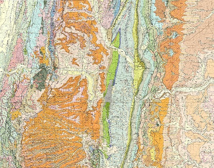
The published map can be found on the Geologic Mapping page along with an index map and PDFs of published quadrangles.
GIS data is available for some quadrangles.
- ►Download content information
-
The digital data for each geologic quadrangle includes a Shapefile Package containing:
1. Shapefiles of the map data that were exported from the file or personal geodatabase.
2. Either a style file specific to each map to aid in symbolizing, or for HSDM maps created
in ArcView 3x, a legend (.avl) file for symbolizing.
3. FGDC_GSC style file for bedrock maps created after 2013 in the NCGMP09 standard
format, where FGDC codes were used for symbolizing.
4. Excel file with explanation of abbreviations, for surficial maps.
The exceptions to 2 and 3 above are some earlier HSDM surficial maps that do not have a file
to symbolize on. All surficial maps do however have an explanation of abbreviations included
in the zip file, and an Code Key in the metadata Description for explanation of surficial units.
Note: The shapefile package does not contain annotation layers due to limitations of the
software.
Metadata specific to each file:
1. Under Resource Details, the Field used to symbolize each shapefile is noted here.
2. A Code Key for surficial map codes is given in the Description.

Surficial 1:24,000

Surficial 1:100,000
Wyoming's Groundwater
 Geothermal Data
A combined download of the primary geothermal datasets from the Wyoming Geothermal Map. Includes thermal springs and wells, geothermal heat estimation, borehole temperatures, deep enhanced geothermal system potential, estimated temperature at depth intervals, and mean surface air temperature.
 Wyoming Aquifer Characteristics
A compilation of hydrostratigraphic designations (aquifer, confining, etc.) based on United States Geological Survey (USGS) research from WSGS groundwater technical memoranda for the Wyoming Water Development Commission (WWDC), on the framework of 1:500,000 scale bedrock geology.
 Baseflow as Recharge
A raster dataset of modelled baseflow representing recharge from a study by the WSGS.
 Saline Groundwater
A quality controlled dataset of saline groundwater samples that occur throughout Wyoming from a study by the WSGS.
 Well and Spring Permits
A comprehensive download from ePermit of Wyoming State Engineer's Office groundwater well permits and spring permits compiled by county, current as of 9/1/2023. As is, no alterations made to data.