Bear River Basin
Between 2001 and 2006, the Wyoming Water Development Commission (WWDC) completed individual water
plans for each of Wyoming’s seven major river basins. The first water plan completed during that
period was for the Bear River Basin (Forsgren and Associates, 2001) and included an available groundwater
determination in Technical Memorandum O. The 2014 Available Groundwater Determination presented in
this report updates and expands the previous technical memorandum with a new compilation of
information and represents the most current assessment of the groundwater resources of the Bear
River Basin.
Bear River Basin Water Plan Update Groundwater Study
The Bear River Basin is an important river drainage in southwestern Wyoming. This publication
represents an intensive collaborative effort among water resource professionals from the WSGS,
the WWDO, and the U.S. Geological Survey. Additional contributors include the Wyoming State
Engineer’s Office, the Water Resources Data System at the University of Wyoming, the Wyoming
Department of Environmental Quality, and the Wyoming Oil and Gas Conservation Commission.
The authors have worked to provide the people of Wyoming with the most current and complete
compilation of groundwater information available in a format that is understandable to water
professionals and citizens alike. Basic concepts of groundwater science are included in
chapter 5.
Downloadable files containing this report and previous memoranda for the Bear River Basin are available online at the
WWDO Bear River Basin Water Plan website.
Greater Green River Basin
 In 2007, the Wyoming Water and Development Commission funded the Green River Basin
groundwater project in order to update the 2001 Green River Water Plan (States West Water Resources
Corporation, 2001). The project was conducted by personnel at the WSGS, U.S. Geological
Survey, Wyoming Water Science Center, and Water Resources Data System at the University of Wyoming.
This study updates, revises, and expands the groundwater report contained in the 2001 Green
River Basin Water Plan as the Available Groundwater Determination Technical
Memorandum, dated May 2006 (Trihydro Corporation, 2001).
A downloadable file containing the water plan, the Available Groundwater Determination Technical Memorandum (Hahn and Jessen, 2001), and this memorandum
are available online at the WWDO Green River Basin Water Plan website.
Platte River Basin
 Between 2001 and 2006, the Wyoming Water Development Commission completed individual water
plans for each of Wyoming’s seven major river basins. The last water plan completed during that
period, for the Platte River Basin (Trihydro Corporation and others, 2006), included an available
groundwater determination in Technical Memorandum 3.3 (Lidstone and Associates, 2005). The 2013
Available Groundwater Determination presented in this report updates and expands the previous
technical memorandum with a new compilation of information and represents the most current
assessment of the groundwater resources of the Platte River Basin.
This study updates, revises, and expands the groundwater report contained in the 2006 Platte
River Basin Water Plan as the Available Groundwater Determination Technical Memorandum, dated May 2006 (Hahn and Jessen, 2001).
Platte River Basin Water Plan Update Groundwater Study
The Platte River Basin is among the most important river drainages in Wyoming in that it covers
one quarter of the state’s surface area and contains more 40 percent of its population. This
publication represents an intensive collaborative effort among water resource professionals from
the WSGS, the WWDO, and the U.S. Geological Survey. Additional contributors include the Wyoming State Engineer’s Office, Water
Resources Data System at the University of Wyoming, the Wyoming Department of Environmental
Quality, and the Wyoming Oil and Gas Conservation Commission. The authors have worked to
provide the people of Wyoming with the most current and complete compilation of groundwater
information available in a format that is understandable to water professionals and citizens
alike. Basic concepts of groundwater science are included in chapter 5.
The downloadable files containing the water plan, the Hahn and Jessen report, and this memorandum are available online at the WWDO Platte River Water Basin Plan website.
Snake/Salt River Basins
 The WSGS, in partnership with the U.S. Geological Survey, has completed its study of the Snake
and Salt River basins, a project for the Wyoming Water Development Commission. The 424-page
publication includes color graphics and foldouts. Geologists conducted a full assessment of the
aquifers of the Snake and Salt River basins as well as a small tributary watershed in Idaho.
They also estimated and mapped water-related information, and evaluated other related studies and
groundwater models for the final published report.
With its headwaters in Wyoming, the Snake River is the largest tributary of the Columbia River,
which ultimately empties into the Pacific Ocean. The Salt River, named for several exposed beds
of salt and briny springs, drains Star Valley in Lincoln County in western Wyoming. Both the Salt
and Snake rivers enter the east end of Palisades Reservoir near Alpine, Wyoming.
The report is available online at the WWDO Snake/Salt River Water Basin Plan website.
Wind/Bighorn River Basin
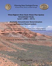 In 2007, the Wyoming Water and Development Commission funded the Wind/Bighorn River Basin
groundwater project in order to update the 2003 Wind/Bighorn River Basin Plan. The project was
conducted by personnel at the WSGS, U.S. Geological Survey, Wyoming Water Science Center, and the
Water Resources Data System at the University of Wyoming.
This study updates, revises, and expands the groundwater report contained in the 2003
Wind/Bighorn River Basin as the Available Groundwater Determination Technical Memorandum, dated January 14, 2003 (Lidstone and Associates, 2003).
A downloadable file containing the water plan, the Available Groundwater
Determination Technical Memorandum (Hahn and Jessen, 2001), and this
memorandum are available online at the WWDO
Wind/Bighorn River Basin Water Plan website.
Northeast River Basins
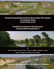 The Wyoming State Geological Survey (WSGS) has completed a groundwater study of the Powder/Tongue/Northeast River Basins (NERB) in northeast Wyoming for the Wyoming Water Development Commission (WWDC).
The study is part of an overall effort to assess groundwater in river basins throughout the state. This was a multi-year project funded by the WWDC.
The NERB encompasses the entire northeast quarter of Wyoming, and includes headwater drainages of the Little Bighorn, Tongue, Powder, Little Powder, Little Missouri,
Belle Fourche, Cheyenne, and Niobrara rivers. The waters from all eight rivers flow ultimately to the Missouri River.
Major sandstone aquifers include the Arikaree, Wasatch, Fort Union, Lance, and Fox Hills formations and the Inyan Kara Group. The Tensleep and Minnelusa formations and the Madison Limestone
are productive limestone aquifers. Of these aquifers, the Wasatch-Fort Union aquifer system has been the most heavily produced.
The Technical Memorandum is available for free download.
-->