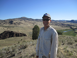
James joined the WSGS in 2019 as a geologist in the Hazards, Groundwater, and GIS division. He holds a B.S. in earth sciences from Montana State University and an
M.S. in geology from Utah State University. He specializes in geologic hazards, geologic mapping, and geomorphology, and is especially fond of any project that takes
him into the field to study geologically active landscapes. In his free time, James enjoys exploring wild places under his own power, generally via via skis, bike, or a
pair of hiking shoes.
- ►Selected Publications
-
Mauch, J.P., Barrette, N.C., and Wittke, S.J., 2022, Preliminary surficial geologic map of the east half of the Jackson Lake 30' x 60' quadrangle, Teton, Fremont, and Park counties, Wyoming: Wyoming State Geological Survey Open File Report 2022-4, 52 p., scale 1:100,000.
Mauch, J.P., Stafford, J.E., and Wittke, S.J., 2022, Geology of Yellowstone map: Wyoming State Geological Survey, at https://portal.wsgs.wyo.gov/arcgis/apps/webappviewer/index.html?id=7013f219b7a7495792f4f8353d8320a7. (Originally published May 2020, revised March 2022.)
Mauch, J.P., Alexander, K.A., and Wittke, S.J., 2021, Preliminary surficial geologic map of the west half of the Jackson Lake 30' x 60' quadrangle, Teton County, Wyoming: Wyoming State Geological Survey Open File Report 2021-3, 22 p., scale 1:100,000.
Wittke, S.J., Mauch, J.P., and Lichtner, D.T., 2020, Preliminary surficial geologic and landslide maps of the Blind Bull Creek and Pickle Pass quadrangles, Lincoln County, Wyoming: Wyoming State Geological Survey Open File Report 2020-5, 16 p., 4 sheets, scale 1:24,000.
|