Interactive Maps
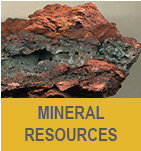
Mineral Resources in Wyoming
This map was developed as an aid to researching and understanding Wyoming’s mines and mineral resources. All data are non-proprietary and were compiled from scientific journals,
the U.S. Geological Survey, the Wyoming State Geological Survey, and the Wyoming Department of Environmental Quality as well as from other state and federal agencies and researchers.
Contact:
Jim Stafford, james.stafford@wyo.gov
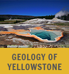
Geology of Yellowstone Map
This map was compiled and designed by the Wyoming State Geological Survey, in cooperation with the Yellowstone Volcano Observatory (YVO), for use as a communication and research tool
for YVO’s partner agencies and the general public. All data presented in this map are publicly available from the U.S. Geological Survey, National Park Service, and other YVO partners.
Contact:
James Mauch, james.mauch@wyo.gov
Groundwater Atlas of Wyoming
This map was developed to enable quick research and comparison of groundwater wells, groundwater quality, aquifers, and recharge across Wyoming. All of the data in this application
are publicly available from the Wyoming State Engineer’s Office, the U.S. Geological Survey, the Wyoming Water Development Commission, and the Wyoming State Geological Survey.
Contact:
Jim Stafford, james.stafford@wyo.gov
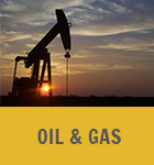
Interactive Oil and Gas Map of Wyoming
This map emphasizes Wyoming’s oil and gas fields, hydrocarbon reservoirs, and associated infrastructure. It supplements, extends and replaces the WSGS’s traditional oil and gas map.
External data resources include the Wyoming Oil and Gas Conservation Commission, the Wyoming Geological Association,
the Wyoming Bureau of Land Management, WyGISC and the Enhanced Oil Recovery Institute.
Contact:
Rachel Toner, rachel.toner@wyo.gov
Geologic and Topographic Map Index of Wyoming
This map presents geologic and topographic maps produced by the Wyoming State Geological Survey and the U.S. Geological Survey as a search tool for researchers and the general public.
Contact:
Katie Lyon, katie.lyon@wyo.gov
Wyoming Geologic Hazards Map
This map enables research of landslides, earthquakes, windblown deposits, expansive soils, and active faults across Wyoming. All of the data presented in this map are
publicly available from the U.S. Geological Survey and the Wyoming State Geological Survey.
Contact:
James Mauch, james.mauch@wyo.gov
Wyoming Geothermal Map
This map offers a method to investigate geothermal data in Wyoming. It enables quick research and comparison of borehole temperatures and geothermal
potential across the state. The data in this application are publicly available from the National Renewable Energy Laboratory, the U.S. Geological Survey, the Southern Methodist University Geothermal Laboratory, and the Wyoming State Geological Survey.
Contact:
Jim Stafford, james.stafford@wyo.gov