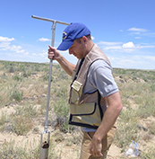
Jim Stafford has been working at the WSGS since 2005, primarily as a resource analyst. His focus is data
analysis/modelling, hydrologic/geologic resource analysis, geospatial science, and cartography. At the WSGS, Jim
has worked across the gamut of geologic topics, and acts as a generalist in hydrogeology, hydrocarbon resources,
stratigraphy, mineral resources, and bedrock mapping.
Jim has a bachelor's degree in environmental science: hydrology from the University of Colorado Boulder and a dual
master's degree in geospatial science and water resources from the University of Wyoming. Jim was born and raised
in Chugwater, Wyoming, and before working at the WSGS he had internships with the WSGS and hydrologic
consulting firms.
- ►Selected Publications
-
Jim's publications can be found on the WSGS Publication Sales and Free Downloads site.
External publications and interactive maps:
Stafford, James, Toner, Rachel, Lynds, Ranie, 2017, Automating oil and gas field mapping in Wyoming: ArcNews -- Esri v. 39, no. 1, p. 22.
Stafford, J.E., Taboga, K.G., and Toner, R.T., 2017, Groundwater atlas of Wyoming: Wyoming State Geological Survey.
Toner, R.N., Lynds, R.M., and Stafford, J.E., 2016, Interactive oil and gas map of Wyoming: Wyoming State Geological Survey.
Stafford, J.E., 2013, Relationships between snowpack and peak streamflows in Wyoming headwaters, Wyoming: Laramie, University of Wyoming, M.S. thesis, 113 p.
Wittke, S.J., and Stafford, J.E., 2018, Wyoming geologic hazards map: Wyoming State Geological Survey.
|